QLD Severe Thunderstorm Warning: Large Hail, Heavy Rain, Damaging Winds |  | Source: Bureau of Meteorology
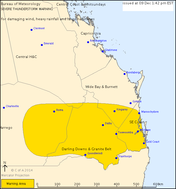
For people in the
Darling Downs and Granite Belt,
Southeast Coast and parts of the
Wide Bay and Burnett and
Maranoa and Warrego Forecast Districts.
Issued at 1:42 pm Tuesday, 9 December 2014.
Severe thunderstorms are likely to produce damaging winds, heavy rainfall that may lead to flash flooding and large hailstones in the warning area over the next several hours. Locations which may be affected include Warwick, Gold Coast, Toowoomba, Brisbane, Dalby, Maroochydore, Roma, Kingaroy, Stanthorpe and Goondiwindi.
Queensland Fire and Emergency Services advises that people should:
* Move your car under cover or away from trees.
* Secure loose outdoor items.
* Avoid driving, walking or riding through flood waters.
* Seek shelter, preferably indoors and never under trees.
* Avoid using the telephone during a thunderstorm.
* Beware of fallen trees and powerlines.
* For emergency assistance contact the SES on 132 500.
EWN Radar & Alerts Map | QLD Facebook Alerts | Twitter Alerts | |