Translate

Southeast QLD Severe Thunderstorm Warning: Heavy Rain


Southeast QLD Severe Thunderstorm Warning: Heavy Rain
Source: Bureau of Meteorology

For people in parts of the
Sunshine Coast,
Brisbane City and
Moreton Bay Council Areas.

Issued at 3:53 pm Friday, 1 May 2015.

The Bureau of Meteorology warns that, at 3:45 pm, very dangerous thunderstorms were detected on weather radar near Caboolture, Peachester, Landsborough, Crohamhurst, Maleny and Montville. Very dangerous thunderstorms are forecast to affect Strathpine, Kallangur, Wamuran and Mapleton by 4:15 pm and Aspley, Albany Creek, Brighton, Lake Samsonvale, Beachmere and Palmwoods by 4:45 pm.

Heavy rainfall that may lead to flash flooding. Rainfall totals of more than 100mm per hour have been recored in the area.

Queensland Fire and Emergency Services advises that people should:
* Avoid driving, walking or riding through flood waters.
* Seek shelter, preferably indoors and never under trees.
* Avoid using the telephone during a thunderstorm.
* Beware of fallen trees and powerlines.
* For emergency assistance contact the SES on 132 500.

EWN Radar & Alerts Map | QLD Facebook Alerts | Twitter Alerts

Unsubscribe | EWN Support | Register

Google Alert - "Queensland Scam"

Google
"Queensland Scam"
As-it-happens update 1 May 2015
NEWS
Brisbane Times
Scam threatens older residents with tax fraud prosecution
Scammers pretending to be the ATO are calling South Brisbane residents and demanding money via a prepaid Visa. Photo: Jessica Shapiro.
Google Plus Facebook Twitter Flag as irrelevant
You have received this email because you have subscribed to Google Alerts.
RSS Receive this alert as RSS feed
Send Feedback

QLD Severe Weather Warning: Damaging Winds & Heavy Rain


QLD Severe Weather Warning: Damaging Winds & Heavy Rain
Source: Bureau of Meteorology

For people in the
Wide Bay and Burnett,
Southeast Coast and parts of the
Darling Downs and Granite Belt Forecast Districts.

Issued at 11:16 am Friday, 1 May 2015.

Synoptic Situation:

A surface low is expected to deepen near Fraser Island and move southwards along Queensland's south coast during the evening and overnight. The low is supported by a strong upper trough moving across the southern Queensland. The upper trough together with the low will move away from the south coast during Saturday.

Heavy rain, which may lead to flash flooding, is expected over areas of the southeast corner, from about Bundaberg to Dalby to Stanthorpe. Further falls of 50 to 150mm are likely, with isolated falls between 200 to 300mm possible, mainly about the coast and with thunderstorms.

Falls of between 100mm to 200mm have been recorded around the Sunshine Coast region since yesterday.

The heavy rain areas should contract towards the Gold Coast by later tonight and are expected to move off the Gold Coast during Saturday morning.

Damaging winds, with peak gusts of around 90km/h are possible near coastal areas as the low moves southwards later today and tonight.

The low is likely to generate large swells causing dangerous surf about the Fraser Island, Sunshine Coast and Gold Coast beaches. The dangerous surf conditions are likely to produce significant beach erosion for these areas. Water levels could exceed the highest tide of the year by around half a metre during this evening's high tide.

A Flood Watch is current for parts of the Wide Bay and Burnett, Southeast Coast and the Darling Downs and Granite Belt forecast districts.

Locations which may be affected include Gold Coast, Toowoomba, Brisbane, Caboolture, Dalby, Maroochydore, Gympie, Noosa, Hervey Bay, Bundaberg, Kingaroy and Stanthorpe.

The Severe Weather Warning for the Central Highlands and Coalfields has now been cancelled.

Queensland Fire and Emergency Services advises that people should:
* Move your car under cover or away from trees.
* Secure loose outdoor items.
* Seek shelter, preferably indoors and never under trees.
* Beware of fallen trees and powerlines.
* Avoid driving, walking or riding through flood waters.
* Keep clear of creeks and storm drains.
* Surf Life Saving Australia recommends that you stay out of the water and stay well away from surf-exposed areas.
* Check your property regularly for erosion or inundation by sea water, and if necessary raise goods and electrical items.
* For emergency assistance contact the SES on 132 500.

EWN Radar & Alerts Map | QLD Facebook Alerts | Twitter Alerts

Unsubscribe | EWN Support | Register

QLD Severe Weather Warning: Heavy Rain & Damaging Winds


QLD Severe Weather Warning: Heavy Rain & Damaging Winds
Source: Bureau of Meteorology

For people in the
Southeast Coast and parts of the
Wide Bay and Burnett and
Darling Downs and Granite Belt Forecast Districts.

Issued at 11:26 am Thursday, 30 April 2015.

Synoptic Situation:

A strong upper trough will move east into the southeastern interior of Queensland on Friday and then will move off the southern coast during Saturday. A surface trough will deepen near Fraser Island during Friday, with a low pressure system most likely developing and slipping southwards over southern Queensland waters during Friday evening and Saturday morning.

A moist wind flow to the south of the surface trough is expected to combine with the upper feature to generate heavy rain, which may lead to flash flooding, over areas southeast of about Hervey Bay to Dalby to Warwick on Friday. 24 hour totals of 50 to 150mm are likely over inland parts, increasing to 200 to 400mm nearer to the coast with some isolated heavier falls possible.

The heavy rain areas should contract southeast during Friday, gradually clearing the Gold Coast during Saturday morning.

Damaging winds, with peak gusts of around 90km/h are possible from tomorrow afternoon near coastal areas as the surface trough develops offshore.

The low will also most likely generate large swells as it slips southwards during Friday and early Saturday, with dangerous surf developing about Fraser Island, Sunshine Coast and Gold Coast beaches.

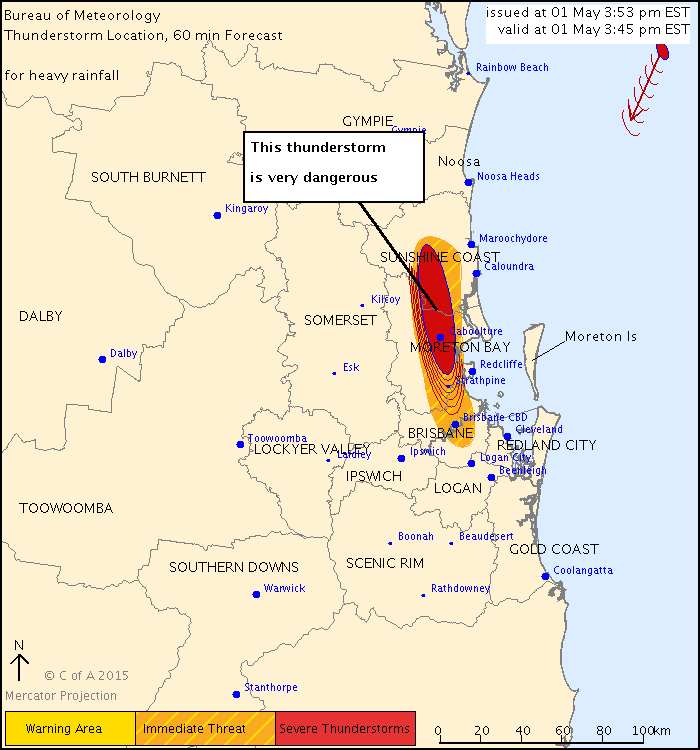
Locally heavy falls are also expected today though are more likely to be associated with thunderstorms. Severe thunderstorm warnings will be issued as necessary.

A Flood Watch is current for parts of the Capricornia, Central Highlands and Coalfields, Wide Bay and Burnett, Southeast Coast, Darling Downs and Granite Belt and Maranoa and Warrego forecast districts.

Locations which may be affected include Warwick, Gold Coast, Toowoomba, Brisbane, Dalby, Maroochydore, Gympie, Kingaroy and Hervey Bay waters.

Queensland Fire and Emergency Services advises that people should:
* Move your car under cover or away from trees.
* Secure loose outdoor items.
* Seek shelter, preferably indoors and never under trees.
* Beware of fallen trees and powerlines.
* Avoid driving, walking or riding through flood waters.
* Keep clear of creeks and storm drains.
* Surf Life Saving Australia recommends that you stay out of the water and stay well away from surf-exposed areas.
* Check your property regularly for erosion or inundation by sea water, and if necessary raise goods and electrical items.
* For emergency assistance contact the SES on 132 500.

EWN Radar & Alerts Map | QLD Facebook Alerts | Twitter Alerts

Unsubscribe | EWN Support | Register